City of Scranton, Pennsylvania
1877 Atlas

G. M. Hopkins, Philadelphia
NOTE: These scans are provided by me, Susan White Pieroth, for your personal genealogy and history research. The images are copyrighted. You may not copy them to another website (links are fine) or publish them  in any form, including on CD for distribution, even if free. If you think I might make an exception, please contact me. I do not sell prints, images on a CD or provide any specific image without the identification "stamps." Map Plates A to J are below. Plates K to U are on the NEXT PAGE. Views and Business Ads are HERE.

The numbers on the index map are ward numbers, the blue letters are for the 21 map plates with blue lines showing the area covered by each plate. The missing page numbers are blank.
Click the images for a larger version (1.6MB) showing the complete double plate. For one twice as large (3.7MB) of just the map section, CLICK HERE.

Buildings and establishments are labeled with owner names. Maps also show building construction materials, city lot and block numbers, ward lines, steam railroad tracks, etc. The map plates do not all have the same scale. The larger version of each image below is over one MB. Map Plates A to J are below. Plates K to U are on the NEXT PAGE.

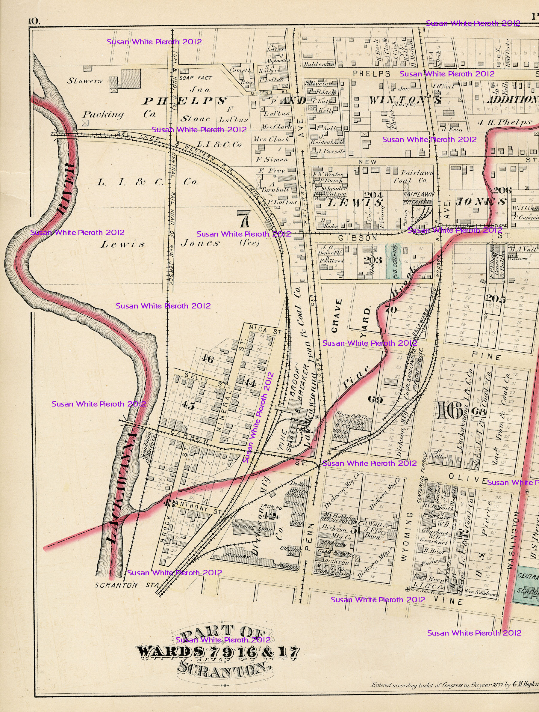
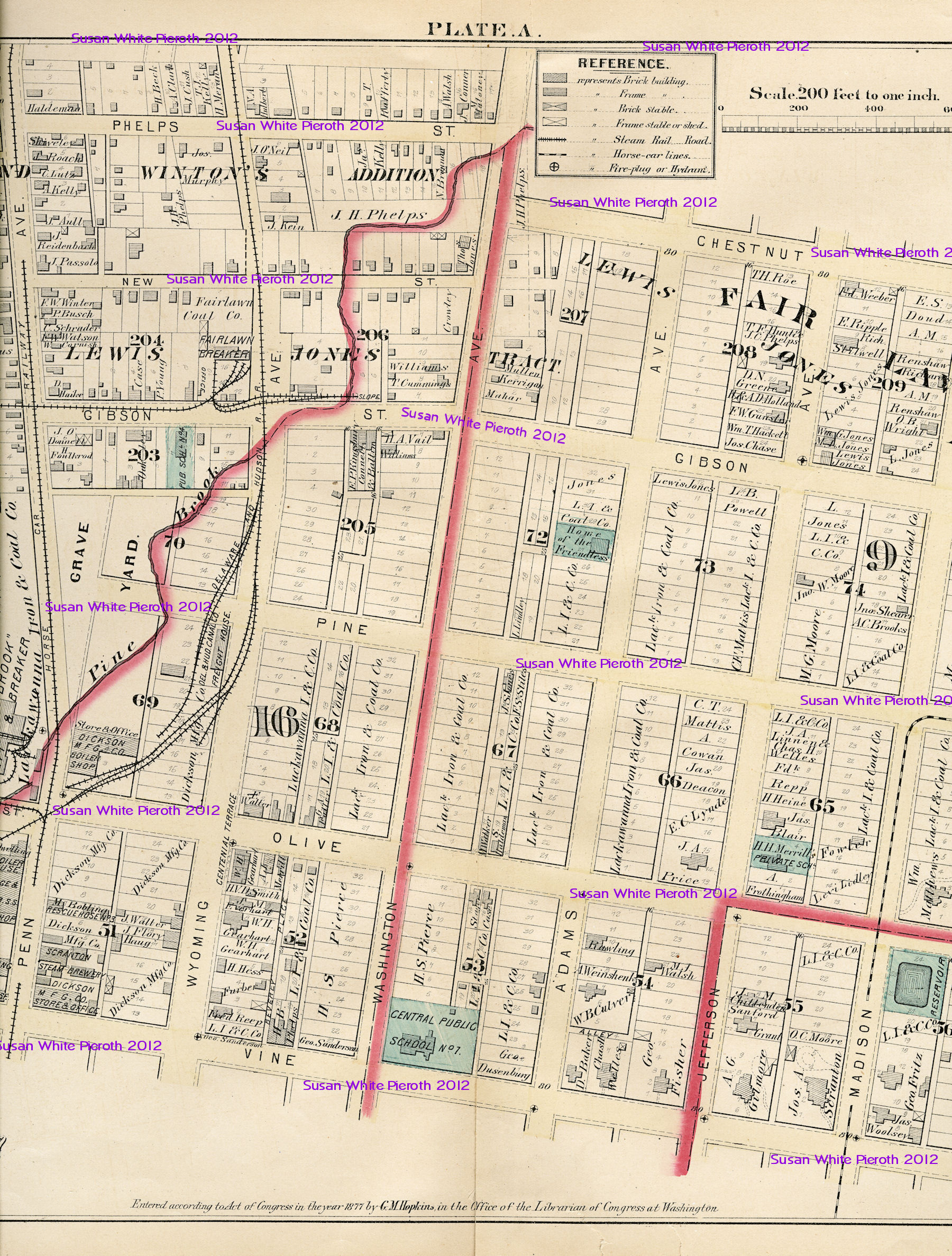
Map plate A: Part of Wards 7, 9, 16, 17
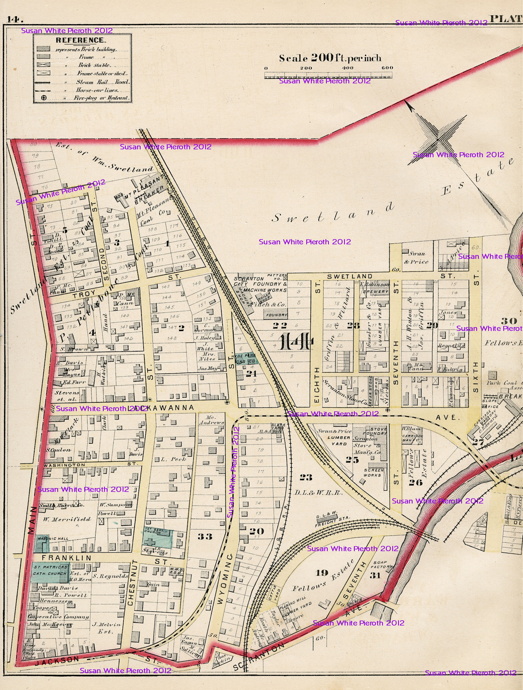
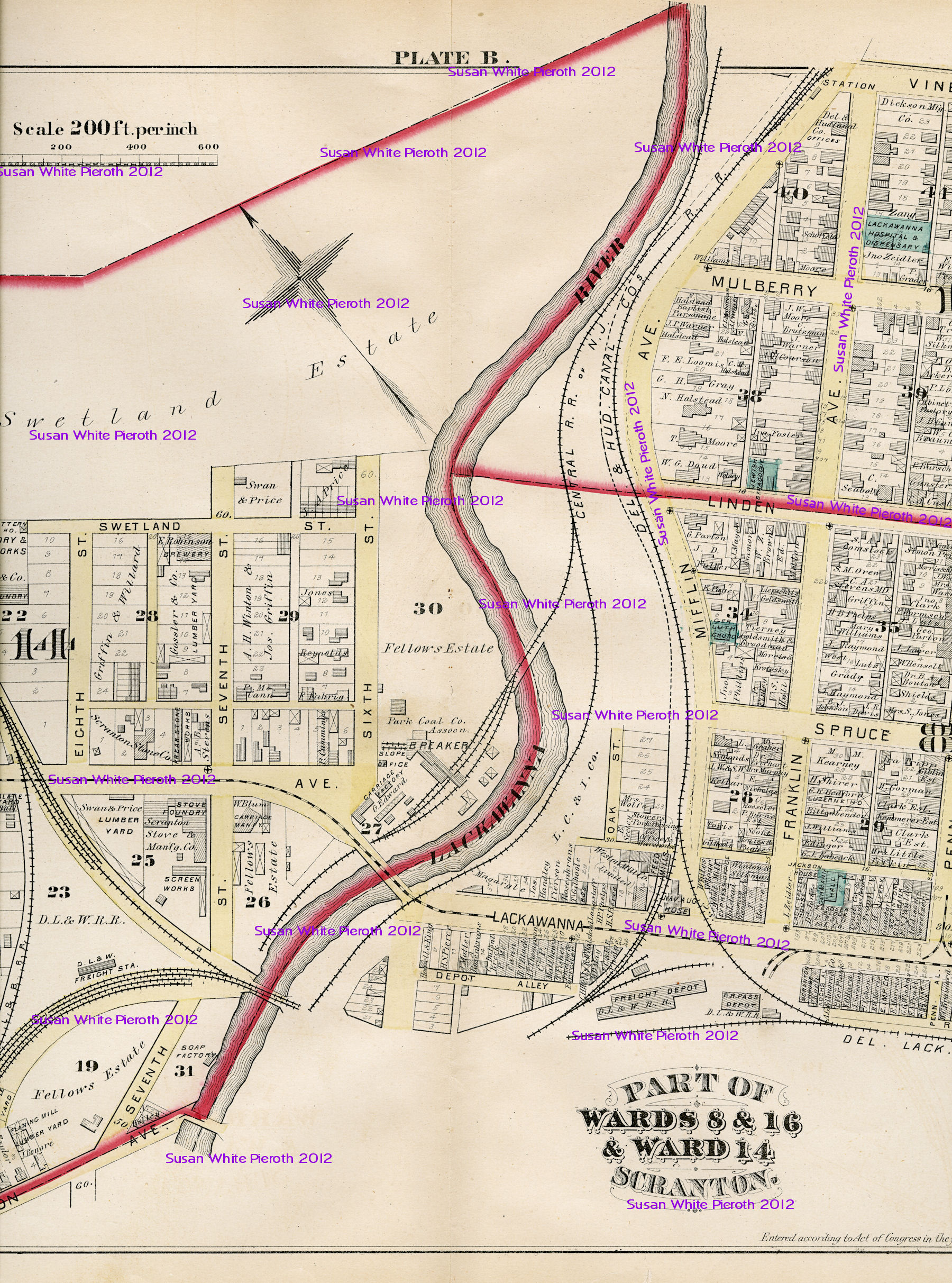
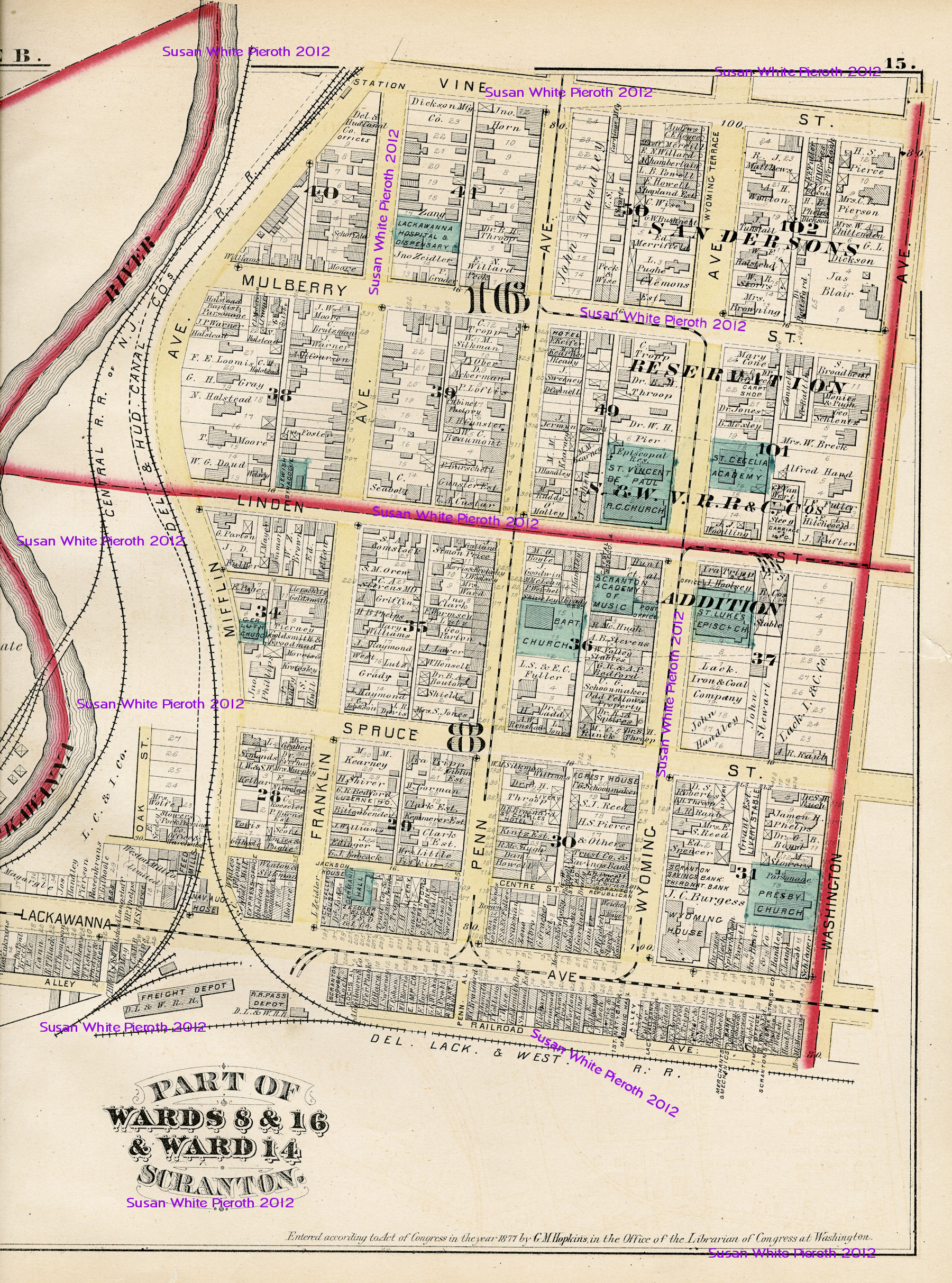
Map plate B: Ward 14 and part of Wards 8 & 16
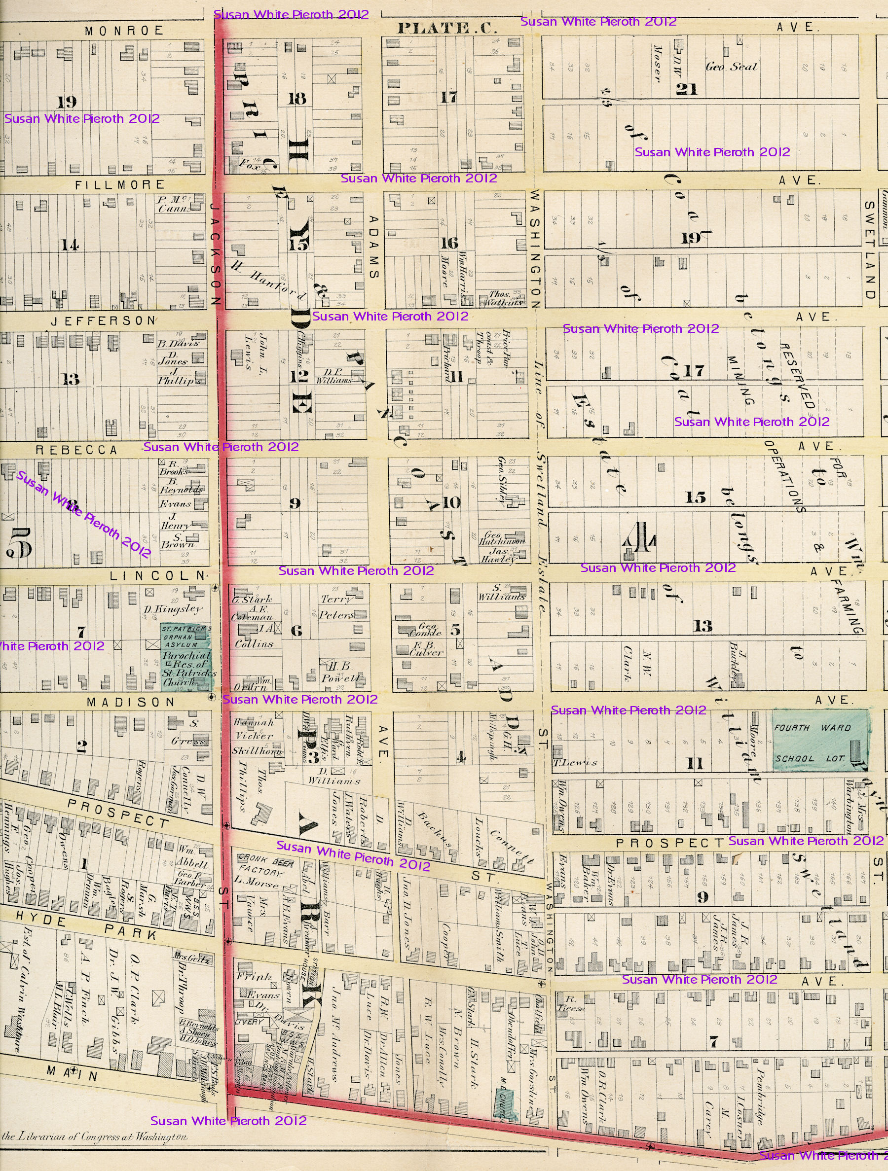
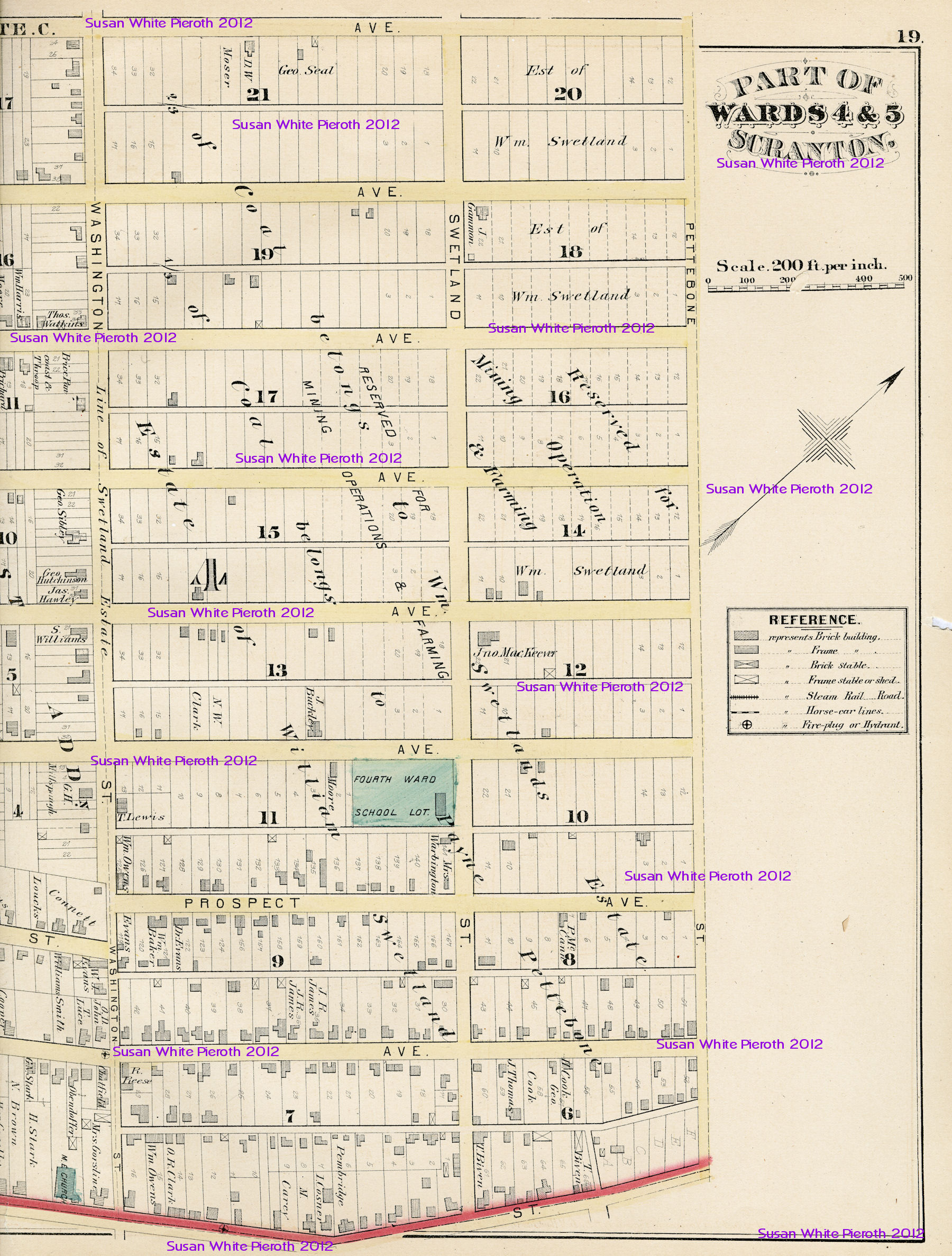
Map plate C: Part of Wards 4 & 5
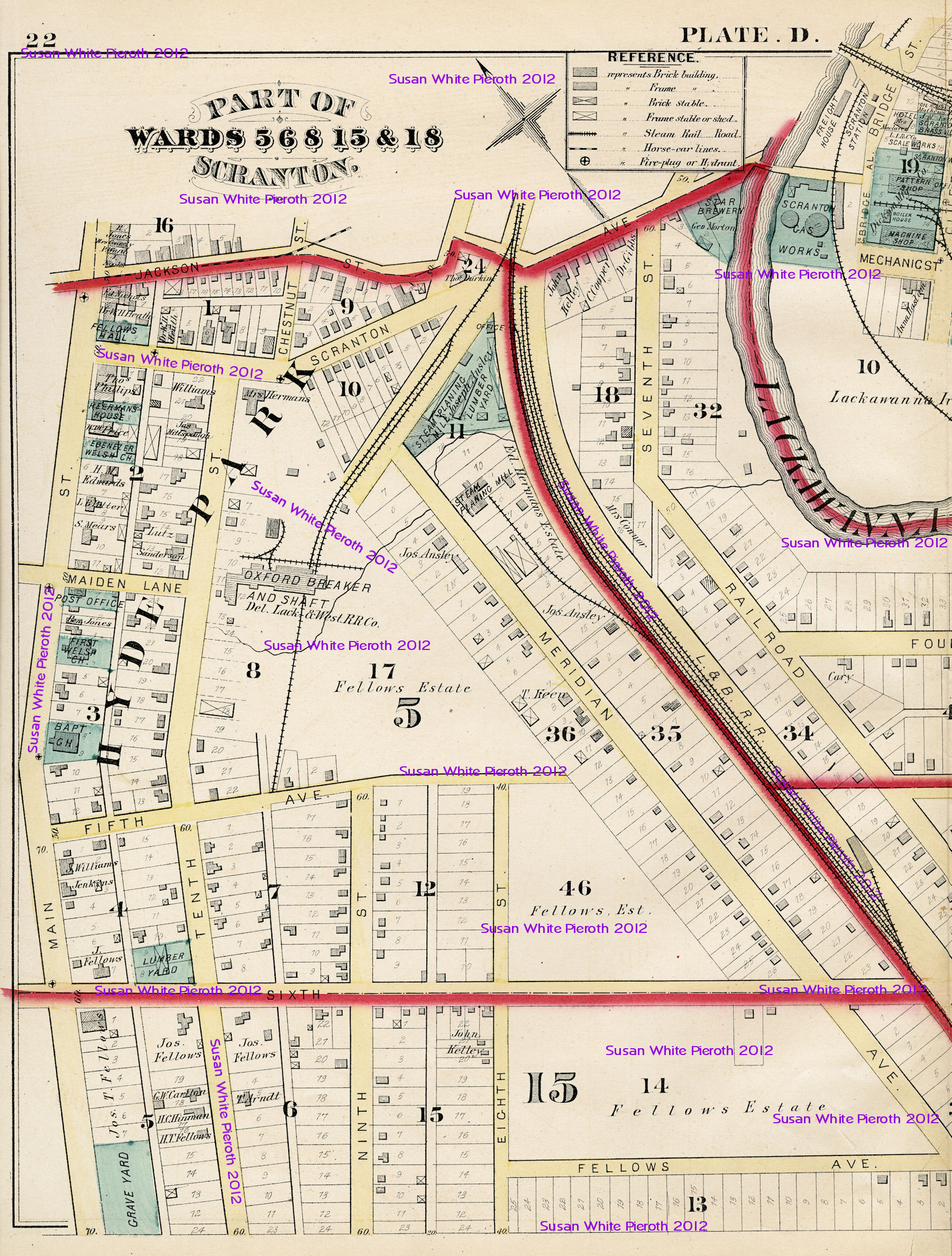
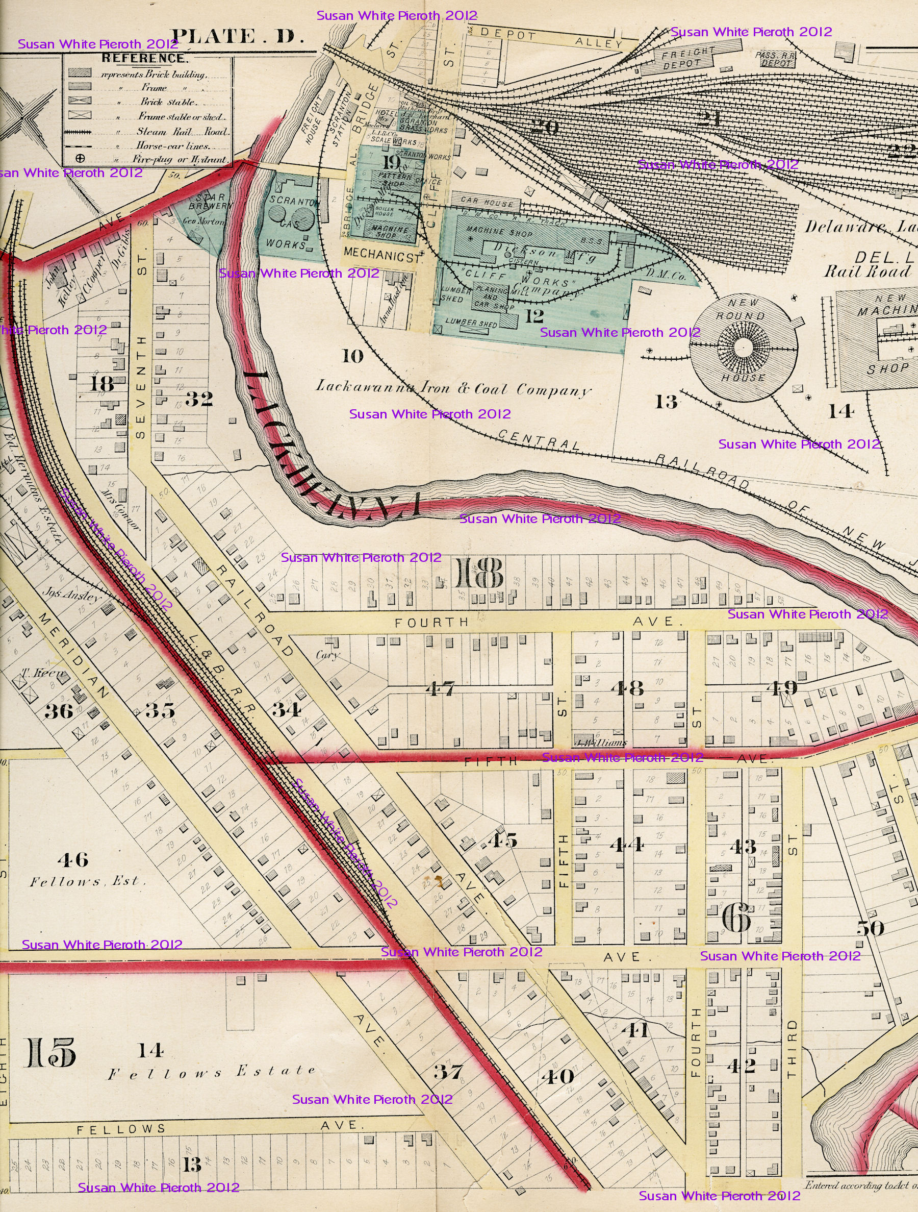
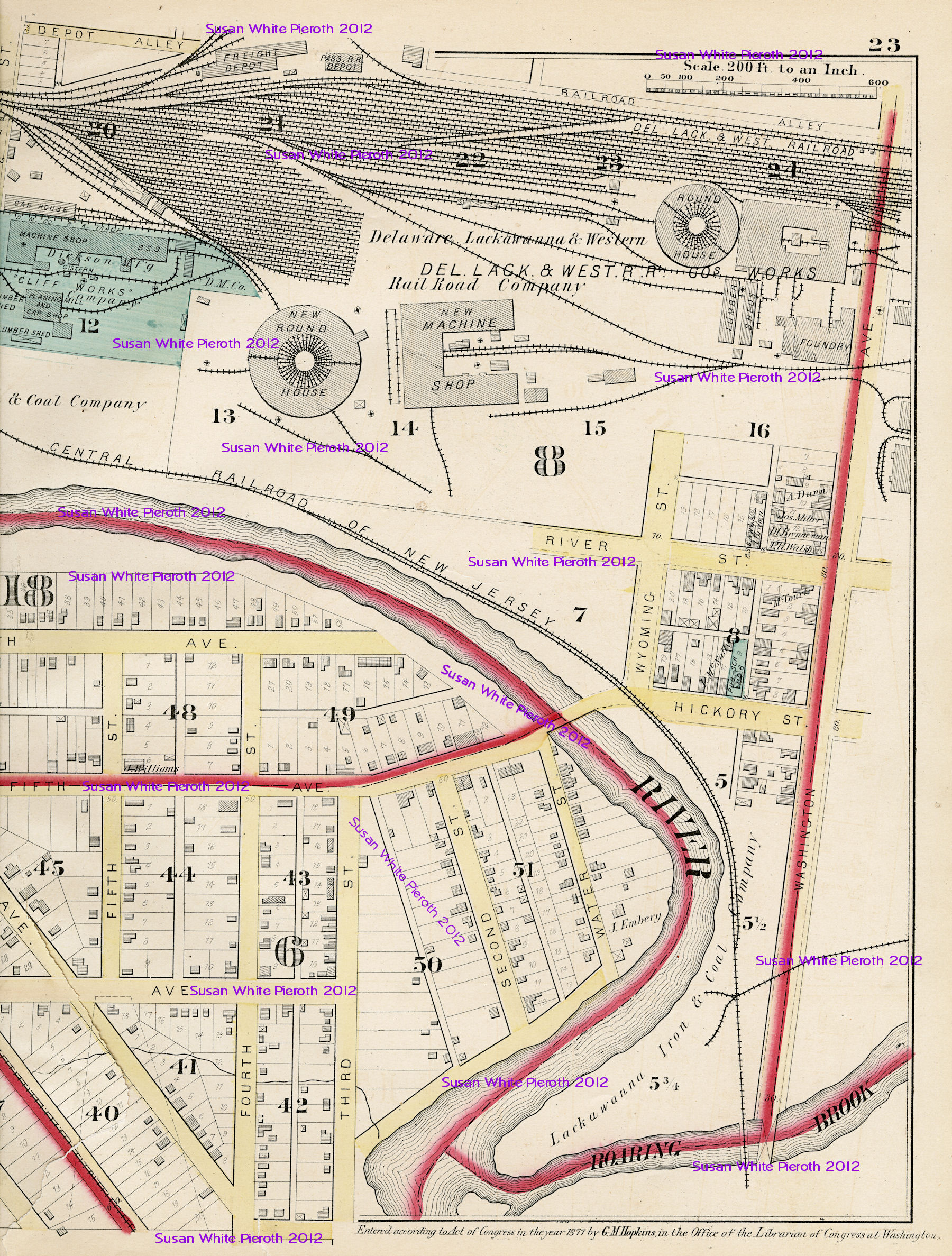
Map plate D: Part of Wards 5, 6, 8, 15 & 18
Map plate E: Part of Wards 9 & 17
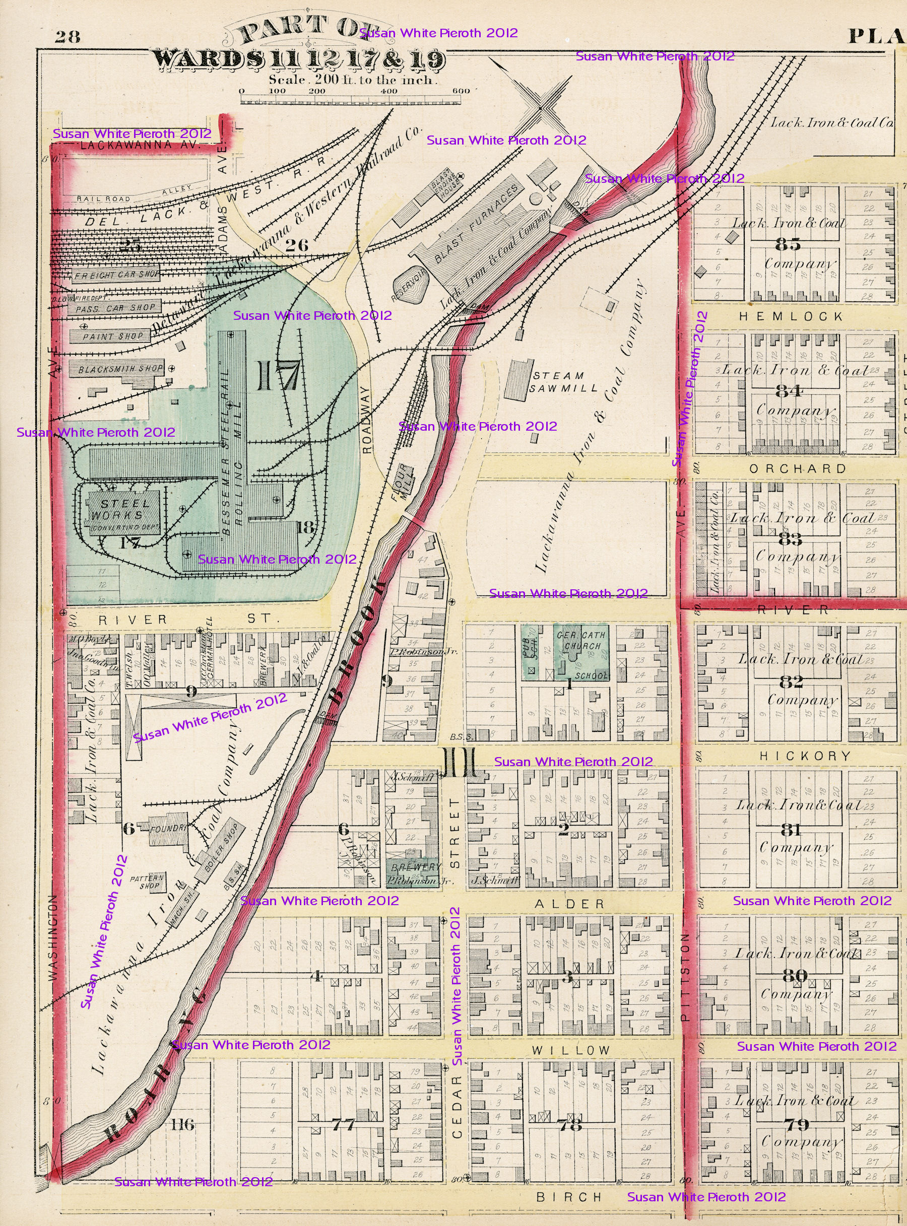
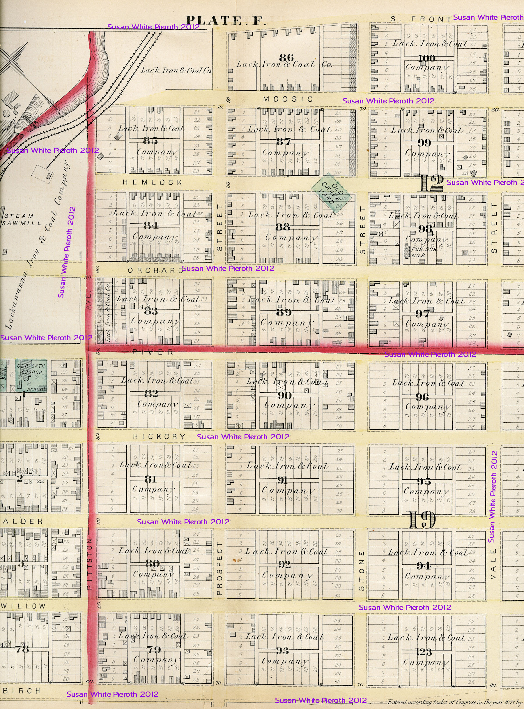
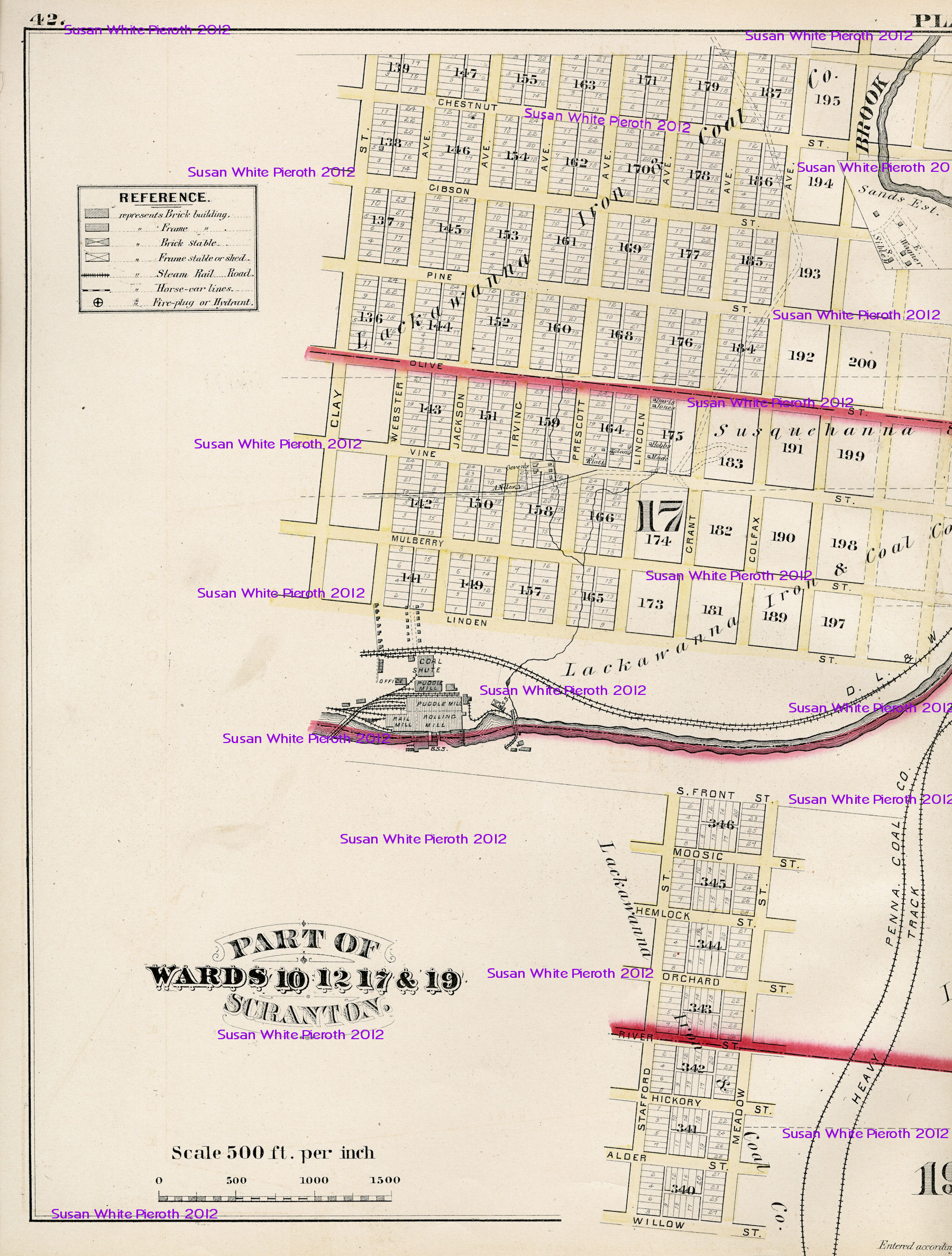
Map plate F: Part of Wards 11, 12, 17 & 19
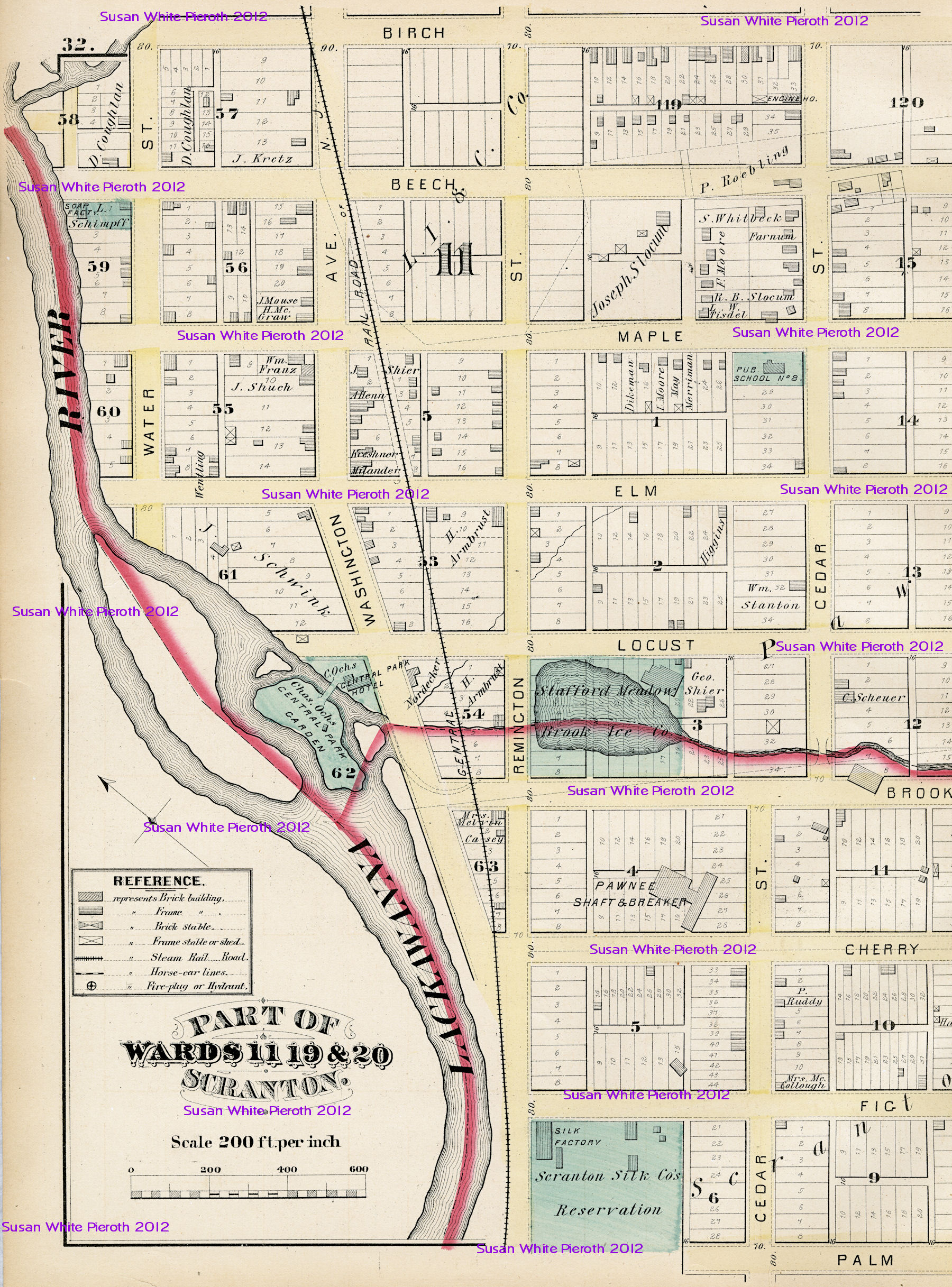
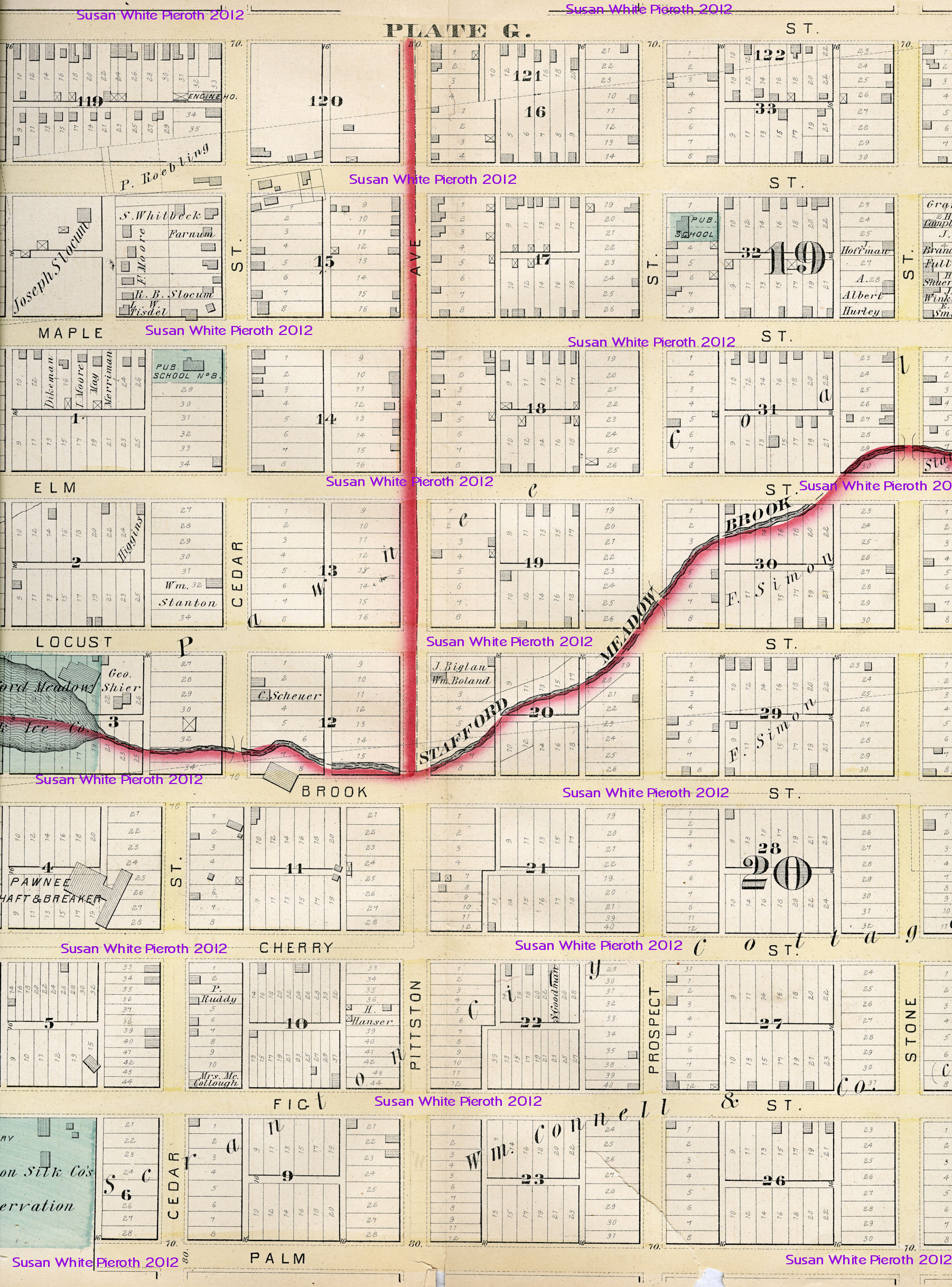
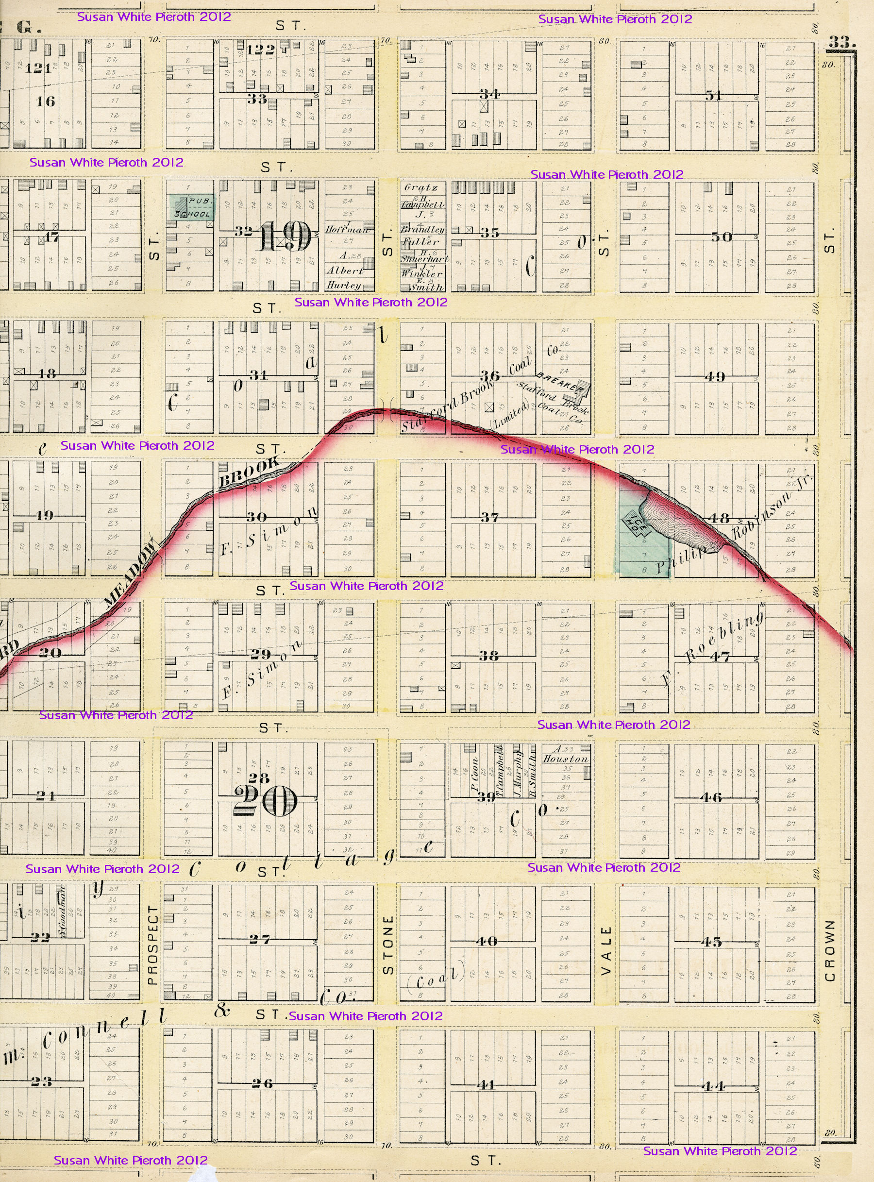
Map plate G: Part of Wards 11, 19 & 20
Map plate H: Part of Ward 20
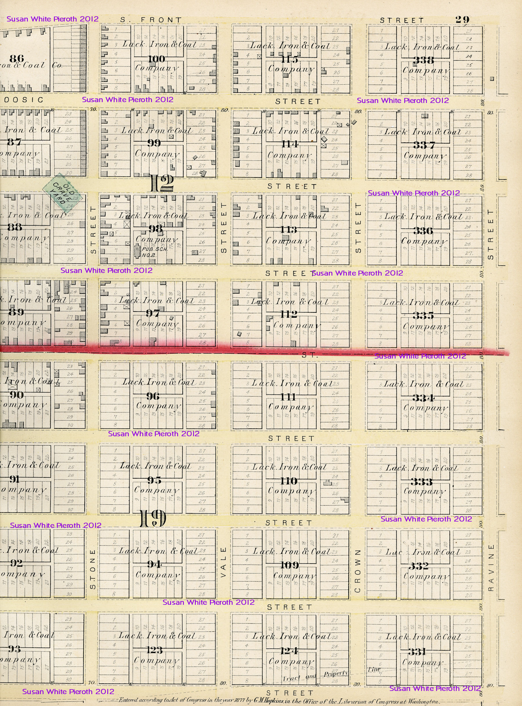
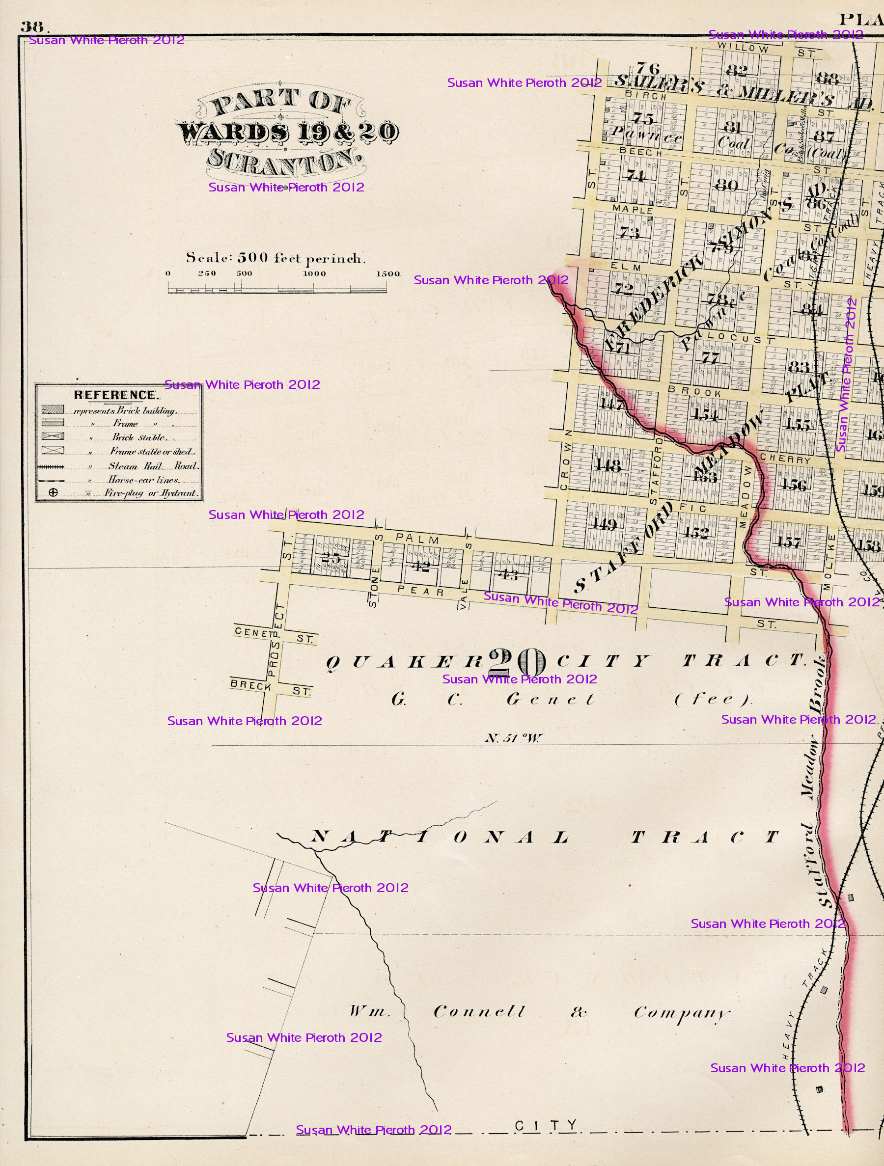
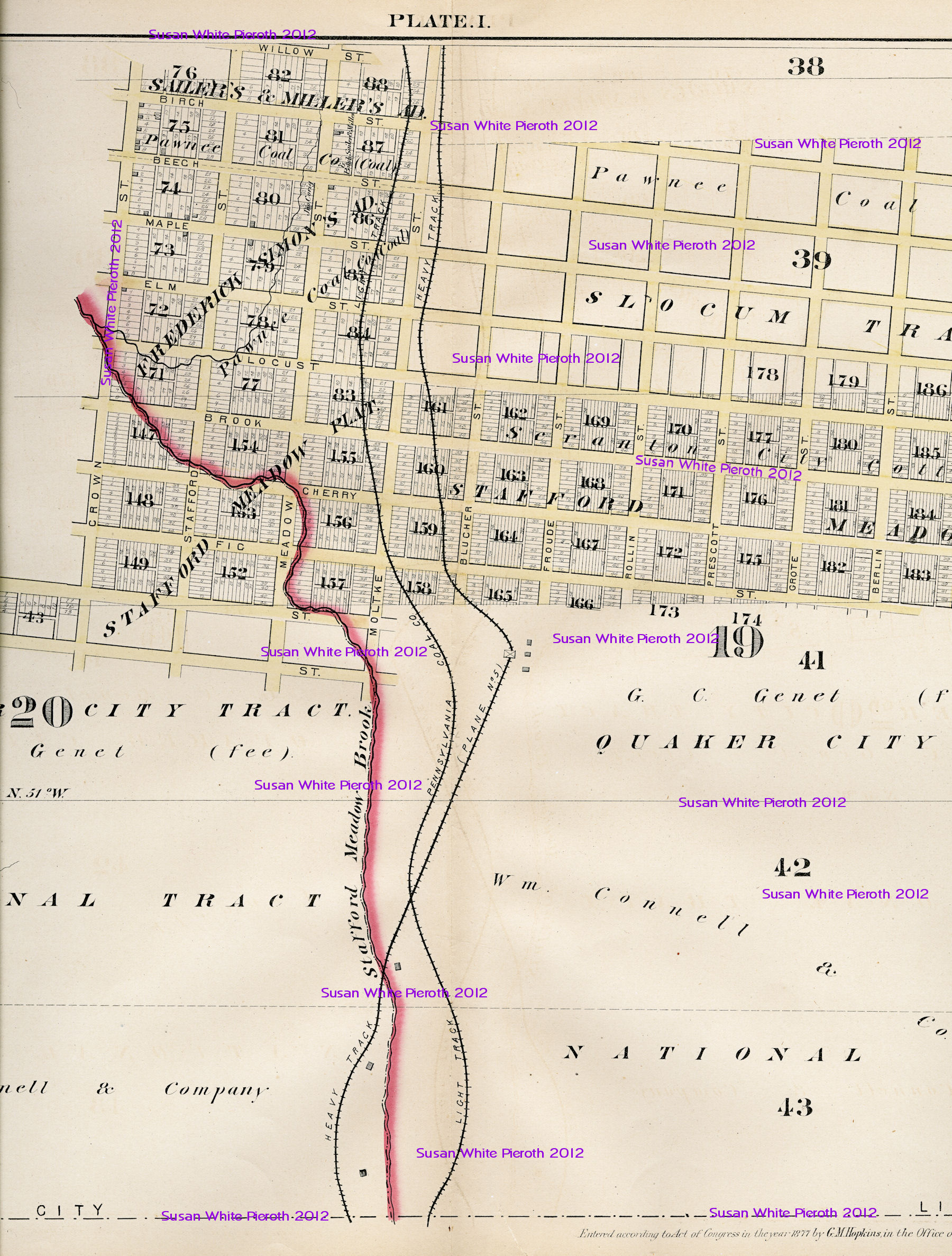
Map plate I: Part of Wards 19 & 20
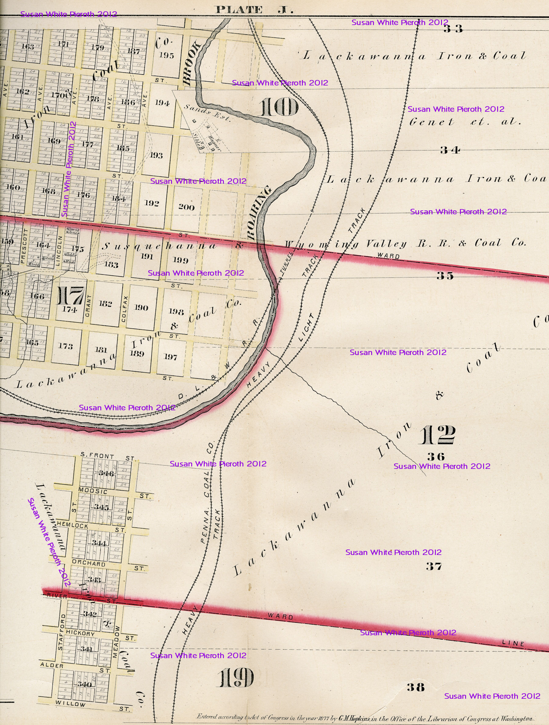
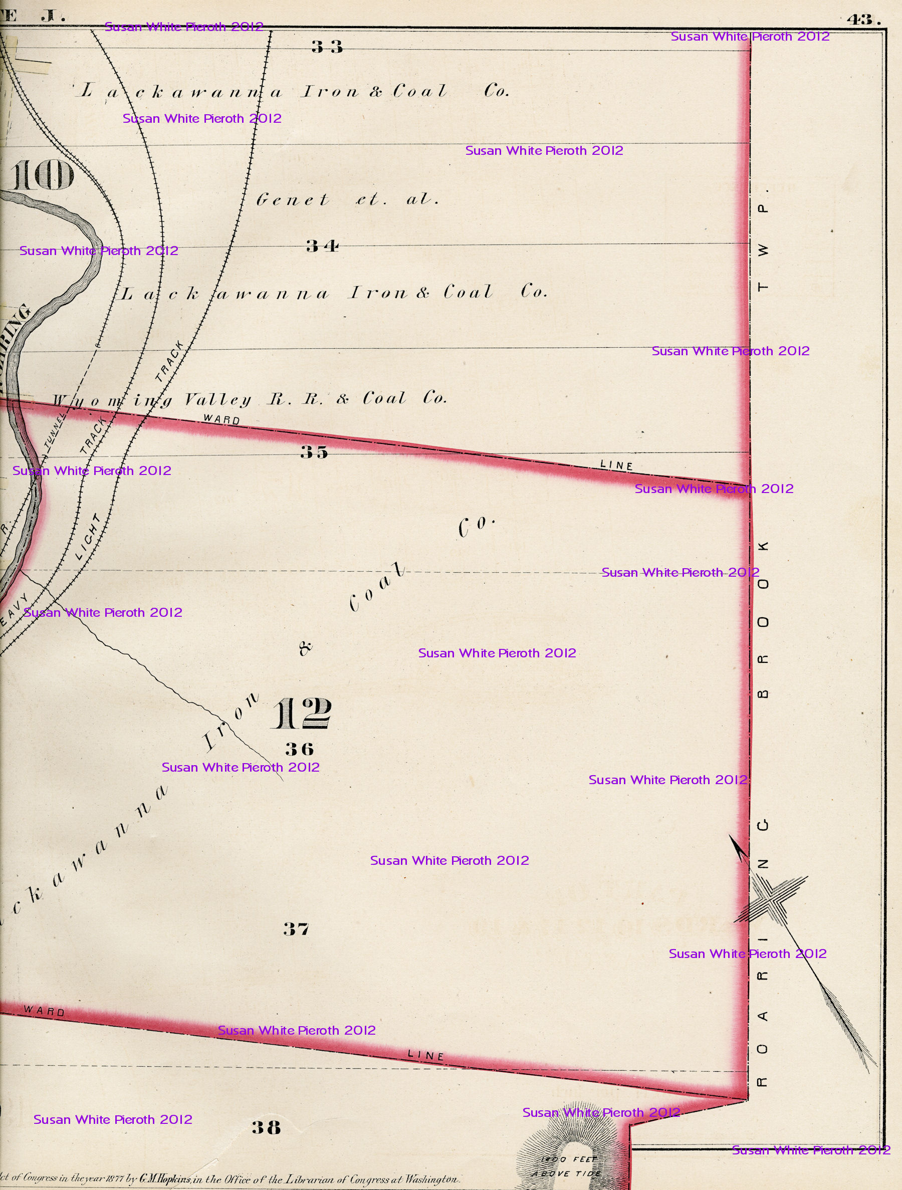
Map plate J: Part of Wards 10, 12, 17 & 19

Maps Continued on Next Page

The text and images on this page may by saved for personal research, but may not be published in any form, including on another web site, without specific permission. Text and images copyrighted 20012 by Susan Carter White Pieroth
Return to the Lackawanna County PAGenWeb Home Page